
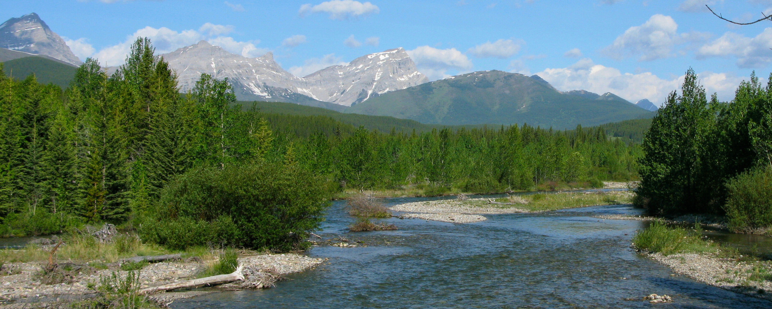
No Net Loss? The Questionable Logic for Destroying Critical Habitat in the Highwood and Loomis Creek
Calgary | Mohkínstsis
September 14, 2026
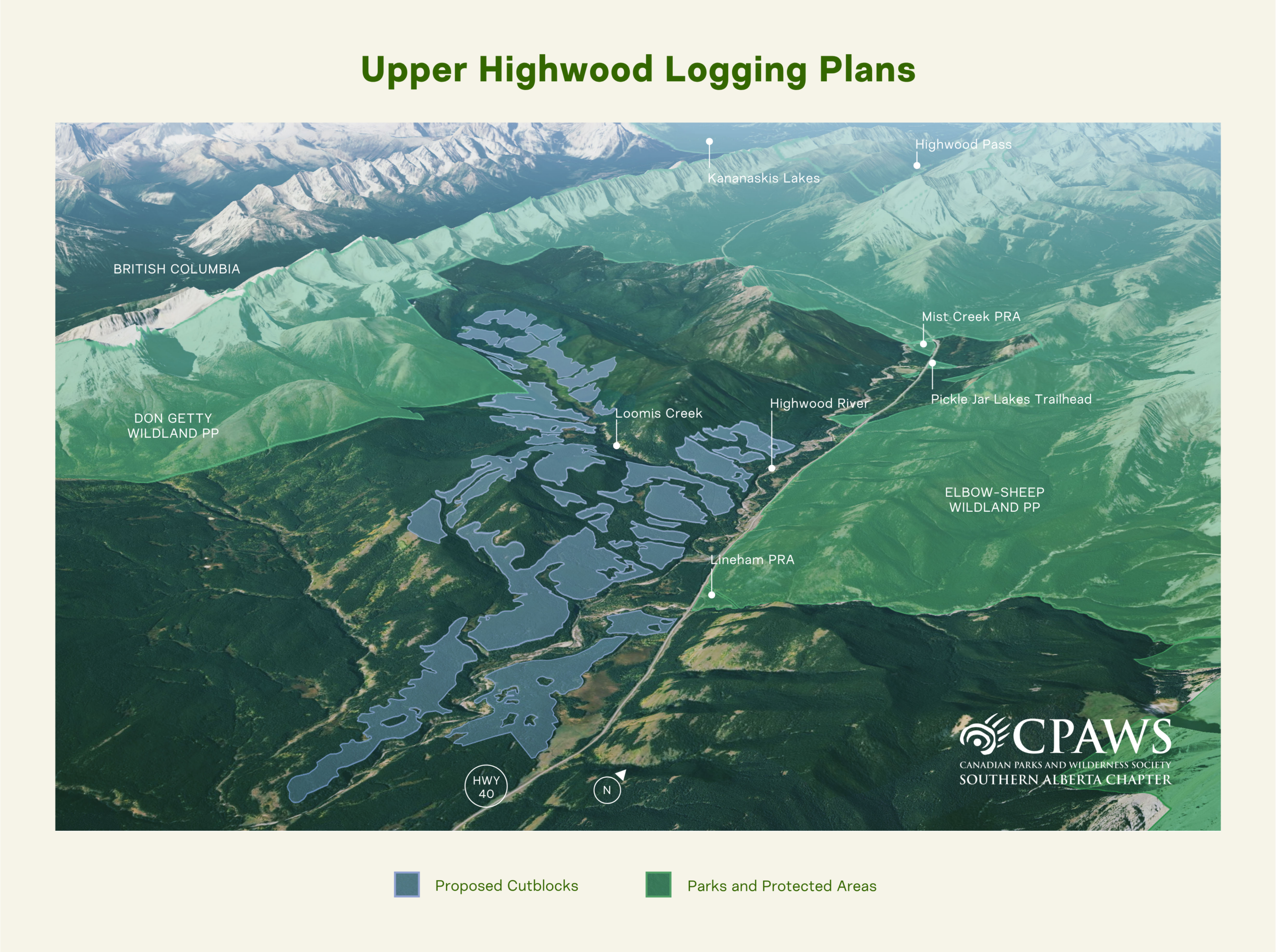
While the Highwood logging is planned to start this winter, on our last field outing on August 28 we observed that bridge construction over the Highwood River had not yet started. As the Restricted Activity Period for development near bull trout habitat commenced September 1, we hope the logging may be delayed another year.
However, Fisheries and Oceans Canada (DFO) has issued a permit to destroy critical habitat to re-build the bridge over the Highwood River, as well as at 13 additional stream crossings adjacent to the Highwood River.
DFO has yet to issue a permit for critical habitat destruction for logging in Loomis Creek.
Destruction of critical habitat is prohibited under the Species At Risk Act. Yet these permits are being approved, in part, based on the assumption that the destruction of critical habitat caused by logging operations in one area can be made up for or ‘counterbalanced’ by restoring habitat, or offsetting, in another area.
As part of the Mitigation Hierarchy, offsetting is intended to compensate for impacts of a project’s activities that remain after all reasonable efforts have been made to avoid, minimize, and remediate harm, with the end goal of achieving ‘no net loss’ or even a ‘net gain’ of habitat.
We’ve already written about how this approach has a very high risk of failure for threatened native trout, how it is inappropriate for a species at risk, how offsetting projects for trout are often unsuccessful, and how DFO itself lacks analysis of the effectiveness of offsetting.
In this post we’ll dive into more detail about the two offsetting plans that are proposed for the Highwood logging, which we received through Access to Information requests.
Avoidance First
Before we dig in, it’s worth remembering, as noted above, that offsetting — per the Mitigation Hierarchy and DFO’s own guidelines — is supposed to be a last resort option, after the avoidance of impacts and the mitigation of those impacts.
However, DFO’s rationale appears to exclude the most fundamental protection measure available under the Species at Risk Act (SARA): simply refusing to authorize activities that would destroy critical habitat. In its public explanation on the Highwood permit, DFO states that “The alternative to ‘do nothing’ at this site is not a reasonable option, as the crossings are required for the harvesting operations.”
By framing the situation this way, DFO treats logging as an unavoidable premise rather than an activity that can be limited, relocated, or denied when it threatens a listed species.
This reasoning is circular and, in our view, undermines the very intent of critical habitat protection under SARA. If logging and associated infrastructure – which are explicitly identified in the species’ Recovery Strategy as a threat – cannot be prohibited within critical habitat because the logging operation itself “requires” destructive clearing and infrastructure, then the designation of critical habitat offers no meaningful protection.
Imagine you hire a contractor to renovate your kitchen. You tell them clearly: “You cannot remove this load-bearing wall, it’s essential to the structure of the house.” The contractor states: “The alternative to removing the wall isn’t reasonable, because our renovation plan requires removing it.” That’s exactly the circular logic at play. They create a plan that destroys the protected thing, then claim the destruction is unavoidable because it’s in the plan.
Under such logic, any industrial activity could be deemed unavoidable simply because the proponent wishes to proceed, effectively nullifying the safeguards SARA is meant to provide.
The Highwood Offsetting Plan
The Highwood logging relies on the “Offsetting Plan for the Decommissioning of Unauthorized Off-Highway Vehicle Access and Restoration of Bull Trout and Westslope Cutthroat Trout Critical Habitat”, a broad plan that is being used to offset impacts from logging in the Highwood, Ghost, and Oldman.
This plan proposes to restore critical riparian habitat at 10 unauthorized stream crossings on off-highway vehicle (OHV) trails on the Livingstone River and its tributaries, and on Waiparous Creek and its tributaries. It claims that this will compensate for the destruction of Critical Habitat at 14 logging road crossings on and near the Highwood River as well as at over 100 sites in other logging plans. And while motorized trails and crossings do have significant impacts and need to be restored, that is some heavy lifting! Especially given the high risk to bull trout from logging and associated infrastructure.
The proposed plan also has some serious issues that undermine the intention of SARA and fail to meet best offsetting practices. Some of these concerns are outlined below.
1. Making up Habitat Loss in Distant Watersheds
The first problem, which is seemingly obvious in the plan, is that while the logging is proposed for the Highwood, the restoration locations are not in the Highwood River watershed.
DFO’s own policy states: “Under most circumstances, offsetting measures should take place in close enough proximity to harmful impacts so as to maintain the function and integrity of the affected ecosystem”.1
There is no plausible way that offsetting projects in different watersheds can directly compensate for habitat losses to the Highwood bull trout population.
2. Time Lags and Uncertainty of Success
The second problem is the timing and uncertainty of restoration success.
DFO’s science advice2 explains that significant monitoring data on the functions and outcomes of offsetting projects is needed to know their impact, which this offsetting plan fails to provide. The advice also states that effectiveness could be assessed by carrying out offsetting prior to proceeding with the project. But this offsetting plan intends for both the offsetting and project to proceed concurrently.
While some offsetting actions, such as decommissioning crossings or restricting access, can be completed relatively quickly, the ecological recovery they are meant to trigger will take far longer. Restoring habitat conditions and reversing historical degradation involves significant time lags, and the success of these measures cannot be assumed. Monitoring is proposed in the plan, but monitoring after the damage has already occurred cannot demonstrate whether the offsets were effective in achieving habitat gains for a threatened species.
Offsets must be implemented in advance, monitored, and shown to be functioning before any destruction of critical habitat is authorized. Only this sequencing can reduce uncertainty and ensure that offsetting actually compensates for ecological loss.
In this case, the clearcut in the Highwood will proceed at the same time as the restoration of 10 stream crossing along the Livingstone River with little baseline data and limited evidence that restoration will be successful or mitigate the impact of the destruction of critical habitat in the Highwood.
3. The Illusion of No Net Loss
A third and major concern is the way that both the impacts and the supposed benefits have been calculated to claim achievement of a “no net loss” outcome.
In standard offsetting practice, restoration ratios are intentionally set much higher than the estimated impact to account for implementation risk, ecological uncertainty, and residual harm. DFO’s own science advice cites international examples where ratios for endangered species range from 20:1 to 30:1 – far above the 3:1 ratio proposed in this OHV-crossing offsetting plan for the Highwood.
And even this claimed 3:1 ratio is misleading. When examined closely, the methodology used in the plan inflates restoration benefits while minimizing the calculated impacts. The plan uses an unconventional approach – with little supporting evidence – that counts not only the riparian area physically restored at each crossing, but also a large downstream area estimated to be affected by sediment from the crossing.
However, this same downstream impact logic is not applied when calculating the area of destroyed critical habitat from logging. For impacts, it is assumed that mitigation measures at new crossings will fully prevent sedimentation downstream and therefore counts only the riparian habitat directly disturbed by logging.
This asymmetry dramatically overstates the benefits of restoration while downplaying the true extent of habitat destruction. This is particularly concerning given the extensive documentation of failed mitigation measures in logging operations, including repeated instances where sediment control structures have not performed as intended (see here and here).
In other words, downstream areas are counted when they help inflate restoration benefits but ignored entirely when they would increase the calculated footprint of destruction.
Signage as an Offset?
The claimed benefits are further inflated by adding a 10% increase in benefit area for installing educational signage at the Livingstone River and Waiparous crossings. It is difficult to see how signage at these locations, however well-intentioned, could meaningfully “offset” the ecological consequences of clearcutting critical habitat for an imperilled trout species in the Highwood River.
Taken together, the plan makes the dubious assertion that restoring riparian habitat at ten OHV crossings will more than compensate for the destruction of critical habitat at 14 crossings in the Highwood and an additional 100+ sites in other planned operations.
Both common sense and established conservation science indicate that this is extraordinarily unlikely. With no supporting data to substantiate these claims, we do not believe this offsetting plan comes close to meeting the standard required for protecting critical habitat.
Loomis Creek Offsetting Plan
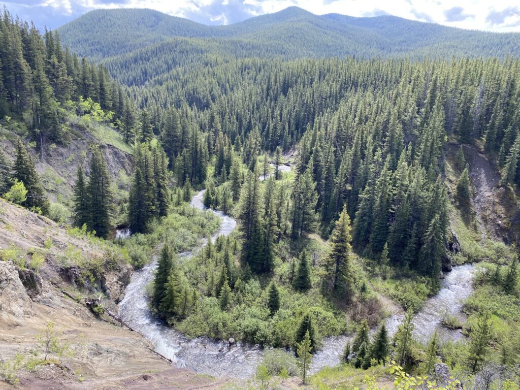
While the Loomis Creek portion of the Highwood logging has not yet been permitted by DFO, West Fraser has proposed an offsetting plan in anticipation of an application for permits to destroy critical habitat. The initial proposed “Fish Habitat Offsetting – Loomis Creek Trail Remediation” plan entails decommissioning a 4.5 km hiking trail along Loomis Creek to counterbalance impacts from roads and destruction of critical habitat at 19 stream crossings planned for logging access.
The Loomis offsetting plan repeats the same asymmetrical and scientifically unsupported calculation of impacts and benefits as the plan being used in the OHV-crossing offsetting plan. Like that plan, it counts large areas downstream that are estimated to be affected by sediment as offsetting benefits, yet it refuses to apply the same downstream impact logic when calculating the project’s own footprint of habitat destruction. The result is the same structural bias: inflated restoration benefits paired with minimized project impacts.
The approach to equivalency is described as “semi-quantitative” and claims to use a “commonly used habitat equivalency framework to assess the relative value of habitats,” but provides no citation or evidence that such a framework exists. In practice, this appears to be another instance of creative accounting, not a defensible ecological assessment.
While in this plan, the reclamation offset areas are at least in the same watershed as the impacts, the Loomis Creek plan introduces another perplexity. The plan says that six of the existing trail crossings of the creek and its tributaries are motorized recreation crossings. However, the Loomis Creek watershed lies entirely within the Kananaskis Public Land Use Zone where all motorized recreation is prohibited.
Since Off-Highway Vehicle (OHV) trails and crossings generally create more impacts than non-motorized trails, the calculation of downstream impacts appears to be inflated, leading to a greater claim to the benefits of restoration. In other words, the plan seems to exaggerate the harm of the existing trail so it can claim greater credit for removing it.
The plan then states that the “success” of decommissioned crossings will be measured by the absence of OHV or recreational use, monitored through trail cameras. Yet it provides no baseline monitoring to demonstrate that illegal OHV use is occurring in the first place. Without baseline data, the claimed benefit of eliminating OHV impacts is entirely speculative.
Although the existing non-motorized trail could be improved, this plan will completely remove it altogether, eliminating public access while simultaneously claiming that the destruction of critical habitat at 19 roads and stream crossings will somehow provide a net ecological benefit. The logic is inverted: removing a low-impact, non-motorized trail is treated as a major gain, while building extensive industrial infrastructure in critical habitat is treated as negligible.
Conclusion
Taken together, these plans reveal a consistent pattern: offsetting is being used as a justification for habitat destruction rather than a credible tool for preventing it. Across the Highwood, Loomis Creek, and other proposed logging areas, there is a reliance on inflated restoration estimates, unsupported assumptions, asymmetrical calculations, and minimization of project impacts. None of the plans provide the baseline data, monitoring, or scientific evidence required to demonstrate that offsets will function as claimed, let alone compensate for the loss of critical habitat for threatened bull trout. With this deeply flawed approach to offsetting the result is not likely to be “no net loss,” but the continued erosion of the very habitats SARA is meant to protect.
More News

What are protected areas in Alberta for if they aren’t, actually, protected?
Is an area really protected in Alberta if its boundaries can be changed at the whim of a Minister?…

Government of Alberta quietly lifts restrictions protecting endangered Greater Sage-Grouse
Provincial habitat protections for the endangered Greater Sage-Grouse have been removed…

Implementation Pathways for Sustainable Tourism in Alberta
Tourism proposals should consider cumulative effects, wildlife movement, species at risk, human-wildlife coexistence, and impacts throughout the entire project lifecycle.…